Explore re-projected dataset in the Med cube
Daily Mediterranean gap-free Level-4 (L4) analyses of the Sea Surface Salinity (SSS) and Sea Surface Density (SSD) at 1/24° of resolution from 2016 to 2022, obtained through a multivariate optimal interpolation algorithm that combines sea surface salinity images from multiple satellite sources as NASA’s Soil Moisture Active Passive (SMAP) and ESA’s Soil Moisture Ocean Salinity (SMOS) satellites with in situ salinity measurements and satellite UHR SST information.
Original Data Source: https://
zenodo .org /records /10635320 Reference: Sammartino et al. (2022)
OSC entry: https://
opensciencedata .esa .int /products /4dmed -2d -sss /collection License: CC-BY-4.0
import xarray as xr
import numpy as np
import matplotlib.pyplot as plt
from pystac_client import Client
catalog = Client.open("https://eoapi.workspace.earthcode.eox.at/stac/")
item = next(catalog.search(collections=["4dmed-2d-sss"]).items())
itemLoading...
item.assets["data"].hrefds = xr.open_zarr(item.assets["data"].href)
dsLoading...
Plot sea surface salinity for a single date
import matplotlib.pyplot as plt
import cartopy.crs as ccrs
import cartopy.feature as cfeature
import numpy as np


# Choose date
date = np.datetime64("2020-06-15")


# Select sea-surface salinity for that date
sos_day = ds["sos"].sel(time=date,depth=0,method="nearest", drop=True)
sos_day
Loading...
# Create map
fig = plt.figure(figsize=(12, 7))

ax = plt.axes(projection=ccrs.PlateCarree())

pcm = ax.pcolormesh(
    sos_day.lon,
    sos_day.lat,
    sos_day,
    transform=ccrs.PlateCarree(),
    shading="auto",
    cmap="viridis"
)

# Basemap features
ax.add_feature(cfeature.LAND, facecolor="lightgray")
ax.add_feature(cfeature.COASTLINE, linewidth=0.8)
ax.add_feature(cfeature.BORDERS, linewidth=0.5)


# Colourbar
cbar = plt.colorbar(
    pcm,
    ax=ax,
    orientation="vertical",
    pad=0.03,
    shrink=0.8
)
cbar.set_label("sea surface salinity")

ax.set_title(f"sea surface salinity - {date}")

plt.tight_layout()
plt.show()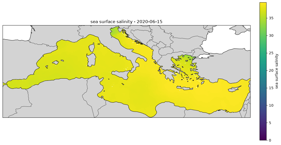
- Sammartino, M., Aronica, S., Santoleri, R., & Buongiorno Nardelli, B. (2022). Retrieving Mediterranean Sea Surface Salinity Distribution and Interannual Trends from Multi-Sensor Satellite and In Situ Data. Remote Sensing, 14(10), 2502. 10.3390/rs14102502